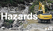
| Natural Hazards in Bhutan |
 |
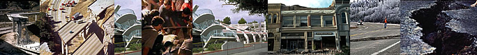
Bhutan Earthquakes |
|
A
6.9-earthquake near Bhutan 2011 |
|
|
Bhutan Earthquakes |
|
Sikkim Quake 2011 |
|
|
 |
|
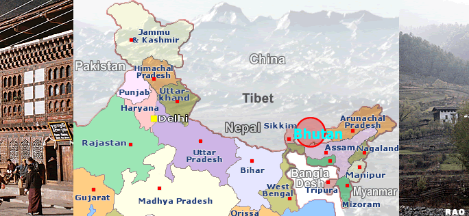
A 6.9-earthquake struck Northeastern Nepal and Sikkim (India)
|
 |
September
20, 2011
The situation on 20 September 2011
An earthquake measuring 6.9 on the Richter scale(see: Richter and Mercalli Scales)struck the Himalaya region bordering north India and Nepal on 18 September 2011 at 6:10 pm Indian time, with the epicentre located 64km north-west of Gangtok, capital of Sikkim, 120km from Shiliguri in the Indian state of West Bengal, 133km from Namche Bazar in Nepal, and 40km from Yadong county in Tibet, China.
 |
| Aftershocks measuring 6.1 and 5.3 on the Richter scale were also felt around Sikkim 20 minutes after the earthquake. The earthquake caused major damages in the region. |
| Images:
NASA |
|
As of 20 September, a total of 99 deaths have been reported, with a breakdown as follows:
Country Death toll
India 83
Nepal 8
China 7
Bhutan1
Total 99
The remoteness of the affected regions, combined with the effects of heavy rainfall and landslides, has posed many challenges in carrying out field assessments to gauge the humanitarian needs. Detailed information on the damage to infrastructure, number of people injured, displaced and affected will be made clearer as assessment are completed in these areas.
India
The death toll of the earthquake in India has reached 83, leaving 200 people injured. Army personnel have battled torrential rain, mist and landslides that have cut off affected areas and stalled relief and rescue work. Nine helicopters were mobilised and 10 medical units were airlifted to Chung-thang in North Sikkim. The biggest challenge now is to get improved access to supply food to needy people. The road beyond Mangan is seriously damaged and it will take some time to restore.
As the road links open up, the enormity of the damage will emerge. Besides the loss to human lives, over 15,000 houses were razed to the ground and more than 100,000 were partially damaged.
Nepal
Current reports from Nepal Red Cross Society (NRCS) district chapters reveal that there are eight dead and 89 injured and over 12,000 people affected across 17 districts. Structural damage to nearly 2,000 houses have left over 1,213 families displaced (more than 7,278 people), who are frightened to return to their damaged homes. It is expected that the true scale of damage and numbers of displaced will increase in the coming days as more isolated areas are reached. Exacerbating the situation has been monsoonal rains and some reports of landslides in the region which are affecting access.
The Government of Nepal's National Emergency Operations Centre (NEOC) has been activated and the District Disaster Relief Committees (DDRC) are convening meetings in affected district headquarters to ensure effective and coordinated response activities. The NRCS district chapters are represented in the DDRCs and will feed back information they have gathered as well as identify areas where there may be gaps in assistance needed.
China
The earthquake affected 13 counties in Shigatse city of Tibet, China. Seven people were killed and 37 were injured. A total of 1,000 houses are reported to have collapsed during the earthquake. The Chinese government has activated the level-four contingency plan to respond to this earthquake. Relief materials were distributed to disaster affected areas and a government working group was sent to assess the situation and carry out relief activities.
Bhutan
According to a report from the Bhutan Department of Disaster Management, the earthquake has caused one death, injured 16, and damaged about 4,000 houses. Further assessment is underway especially in remote and scattered villages. The International Federation of Red Cross and Red Crescent Societies (IFRC) South Asia regional office is in close contact with the Department of Disaster Management and will continue to monitor outstanding needs of the affected population.
 |
| Source: International Federation of Red Cross and Red Crescent Societies (IFRC, September 2011) |
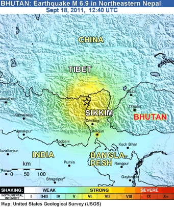 |
| Earthquake Details |
provided by United States Geological Survey (USGS) |
| Magnitude |
6.9 |
| Date-Time |
* Sunday, September 18, 2011 at 12:40:48 UTC
* Sunday, September 18, 2011 at 06:10:48 PM at epicenter |
| Location |
27.723°N, 88.064°E |
| Depth |
10 km (6.2 miles) set by location program |
| Region |
SIKKIM India |
| Distances |
68 km (42 miles) NW of Gangtok, Sikkim, India
119 km (73 miles) NNW of Shiliguri,West Bengal, India
272 km (169 miles) E of Kathmandu, Nepal
572 km (169 miles) N of Kolkata (Calcutta), West Bengal, India |
| Location Uncertainty |
horizontal +/- 13.5 km (8.4 miles); depth +/- 3.5 km (2.2 miles) |
|
|
|
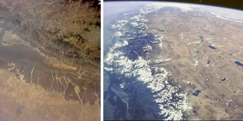
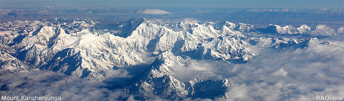
Mount Kanchenjunga (Taplejung, Nepal), border area to Sikkim
|
|
Links
|
|
|
 |
|
External
link |
top
| Information on Bhutan |
|
|