| Natural Hazards in Bhutan |
 |
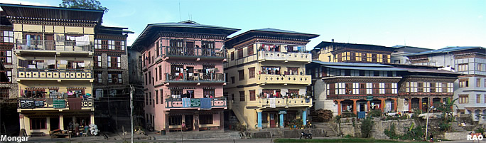
Bhutan Earthquakes |
|
|
Bhutan Earthquakes |
|
|
 |
|
A
5.7-earthquake struck Bhutan
|
 |
February
14 and 15, 2006
 |
| Up in fright, rattled by an earthquake which struck
around 6:55 am (Bhutan Standard Time) early morning on February 14, 2006. The
tremour was the second to hit Bhutan this week. |
| Images:
NASA |
|
On
February 11,2006, a slight tremour, measuring 5.0 on the Richter scale(see: Richter and Mercalli Scales) was felt
in Trashigang and the neighbouring region with its epicenter located in
the Indian state of Arunachal Pradesh.
The
February 14's tremour, which lasted for about seven seconds, was described
as one of 'moderate intensity' and measured 5.7 on the Richter scale.
The
epicenter, the point on the surface of the earth vertically above the place
of origin of the earthquake, was located at latitude 27.7 degree north
and longitude 88.8 degree east in Sikkim, India, about 130 kilometres west
of Thimphu, according to the India Meteorological Department (IMD) in New
Delhi.
While
many Thimphu residents expressed concern over the event, the Standard and
Quality Control Authority officials, who have been studying the seismic
activity in the country, said that no damage to houses or property had
been reported so far. "The tremour was mild and largely harmless," said
one of the officials.
However,
in Gangtok, Sikkim, and elsewhere, extensive damage and cracks in several
buildings have been reported.
Sources
reported that strong and sudden jerks were felt sending people out of their
houses in panic.
The
quality control officials explained that a stronger tremour was expected
in Gangtok, and other areas as it was situated nearer to the epicenter.
"Places which are closer to the epicenter will have more intensity than
those located farther away," said one official, adding that the intensity
was determined by certain aspects like damages, peoples' reaction, and
change in ground conditions among others.
The
officials added that this also explained the strong tremour experienced
on March 26, 2003. Although of less magnitude in comparison, the 5.5 earthquake
with its epicenter located at Gunitsawa in Bhutan-China border was of higher
intensity.
Bhutan
falls under zone V of the seismic zoning map of India, which is described
as 'seismically very active'. A report published in the US in 2001 has
predicted a major earthquake in the Himalayan region which was to occur
'very soon'.
Between
1937 to 1998 a total of 30 earthquakes have been recorded in Bhutan. Records
with the department of geology and mines indicate that a 1941 earthquake,
on January 21, was the most powerful, measuring 6.75 on the Richter scale.
Geologists
with the department said that with no proper seismic stations in place,
it was difficult to detect any seismic activities in the country.
 |
| Contributed
by Karma Choden, KUENSEL, Bhutan's National Newspaper, 2006 |
top
|
A
5.5-earthquake struck Bhutan
|
|
March
26, 2003
An
earthquake of moderate intensity rocked Bhutanese off their bed and houses.
The tremor lasted for about 10 seconds. Except for reportedly new cracks
in some houses, there was no report of loss of life or severe damage to
property. The earthquake was a 5.5 temblor at the Richter scale (see: Richter and Mercalli Scales). The epicenter
was located at latitude 27.49 degree north and longitude 89.27 degree east
in around Gunitsawa in Bhutan-Tibet border.
In
the early hours of March 26, 2003, nearly every family in Bhutan woke up in fright,
rattled by an earthquake that measured between 5.1 and 5.5 on the Richter
scale. Most people were still shaken long after the tremour had died.
Apart
from the stories exchanged by school children, that included the excitement
of dashing outdoors to wait for a dreaded second tremour, most people had
an earthquake story to tell. The older generation even had vivid memories
of past earthquakes although earthquakes have never caused major tragedies
in Bhutan. Bhutanese astrologers have varied interpretations of earthquakes.
And, as is the nature of oral societies, we hear a range of predictions
related to earthquakes. Some of them are a little foreboding.
Superstitions
aside, we have very good reasons to be alert. Bhutan has recorded 30 earthquakes
in 65 years. Meteorologists warn us that Bhutan lies in a high-risk seismic
zone. Statistics tell us that our region - Nepal and the nearby Indian
states - has experienced a number of earthquakes that measured more than
8 on the Richter scale. There is every reason to believe that we might
experience a similar tremour.
| The
Himalayas and the Tibetan Pleateau were formed and continued to be modified
by the convergent collisions of two of the world's great continental tectonic
plates, the Eurasian plate and the Indian-Australian plate. As a result
of the collision that started more than 65 million years ago, the average
elevation of the Tibetan Plateau in the intermountain valleys is
approximately 4880 meters. |
| This
article was contributed by KUENSEL, Bhutan's National Newspaper 2003 |
|
top
| Information on Bhutan |
|
|