|
Nepal EDUCATION |
|
|
 |
|
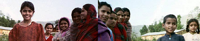
| Education
in Nepal |
 |
| Nepal:
The country context |
 |
Nepal
is a small country of 147, 181 sq. km. in the South Asia region having
885 km in east-west direction and with a mean north-south width of 193
km. Two great neighbours border it, the People's Republic of China in the
north and India in the south, east and west. The country is located between
26°20' and 30°10' north latitude and 80° 15' and 88° east
longitude and presents a unique transition zone between arid, cold and
sparsely populated Tibetan Plateau of China in the north and humid, hot
and densely populated India in the south.
The
Great Himalaya Range, bordering along the northern line along the eastern
half of the country, towers to the height of 8848 meters. Along the western
half of the country, Nepali land is extended beyond the north of Himalayas
as well. That is, in the west, the Himalaya Range passes from within Nepal.
High altitudinal variation along less than 200 km north south expansion
of the country which is more than 8000 meter at places, has resulted in
great physiographical, environmental and cultural variation in the country.
As a result of several physical and historical factors, numerous natural
and sociocultural patterns are developed in the country, making it immensely
rich in bio-diversity and natural as well as cultural resources. The fact
that the Population Census, 2001 registered 101 different caste groups,
92 language groups, and ten religious groups is one small example of this
cultural resource.
However,
the present reality is that income poverty is pervasive in Nepal. According
to a recent estimate, GDP per capita is only about US$ 240. In this country
of 23.1 million people with an average annual growth of 2.24 per cent,
38 per cent of the total population are estimated to be below poverty line.
In a global poverty index (2001) Nepal ranked 77th among 90 countries.
The National Human Development Report (2002) calculated Nepal's Human Development
Index as 0.466 and Human Poverty Index as 39.2. Agriculture makes a contribution
of about 40 per cent to the national GDP and about 80 per cent of the total
population derive their livelihood from this sector. In this country where
about 86 per cent of the total population live in rural areas, life expectancy
is estimated to be about 60 years and adult literacy (15 years and above)
is only 48.6 per cent (female - 34.9, male - 62.7). Several socioeconomic
indicators show high disparities in terms of gender, region, location (urban/rural),
ethnic groups, economic groups, etc. However, it should be noted here that,
as a result of several development interventions in the past years, many
of the socioeconomic indicators are showing an improving trend.
The
country is divided into three distinct ecological regions - terai, hill
and mountain. The terai in the south is a narrow strip of hot alluvial
plain that runs from east to west of the country but is broken at two different
places - Dang and Chitawan. It consists 23 per cent of the total land area
of the country. Due to fertile soil, easy access and better infrastructure
the region has been traditional destination of migrants from the hill and
the mountain in the north. As a result the region now includes 48 per cent
of the total population of the country. The hill region, lying between
the terai in the south and the high mountains in the north, is a complex
region of hills and valleys and river basins. Expanding to about 42 per
cent of the total land area, the region includes 44 per cent of the total
population of the country. The mountain region, a region of high-rise mountains,
high valleys and harsh climatic conditions, covers 35 per cent of the total
land area but includes only about eight per cent of the total population.
The
country is divided into 75 districts and 5 development regions for its
administrative purpose. The development regions are made up of districts.
There are 16 districts in Eastern Development Region and 19 in Central
Development Region. Western Development Region consists 16 districts and
Mid-Western and Far-Western Development Regions include 15 and 9 districts
respectively.
Each
district is divided into a number of village development committees and
municipalities. Currently there are 3,915 village development committees
and 58 municipalities including one metropolitan (Kathmandu) and four submetropolitan
cities (Biratnagar, Birganj, Lalitpur and Pokhara).
The
history of modern schooling in Nepal began about 150 years ago with the
establishment of the first school in 1853. However, for many years to come
this school did not welcome children of the public and remained restricted
for the ruling family. The political change in 1951 brought fundamental
changes in the educational scenario, beginning the expansion of schooling
facilities in the country. The progress achieved over the past 50 years
in education can be seen in the fact that there now is a well-spread network
of 26,000 schools (including higher secondary), 414 colleges, five universities
and two academies of higher studies where 5.5 million students and 150,000
teachers are involved in teaching learning process. This expansion of schooling
facilities and thus the educational opportunities in the country has positive
influences in the local and national development, in the social empowerment
as well as in improving the living standard of the people.
However,
there are many challenges. At primary level, 19 per cent of the total school
age population is still out of school and at secondary level; proportion
of such population is about 40 per cent. Disparities in terms of gender,
ethnic and economic groups, locations are quite high. Questions of educational
management, quality and relevance are critical and making the system more
efficient has remained a difficult task. In order to address these questions
the government has been implementing various programs related to improving
access, equity, quality and management of education.
|
|
| Source:
Nepal Ministry of Education and Sports MOES |
top
|
Links
|
|
|
 |
|
Externe
Links |
|