| Glacial Lake Outburst Floods GLOF |
 |
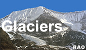
Bhutan Glaciers - Glacial Lakes |
|
Bhutan Information |
|
|
 |
|
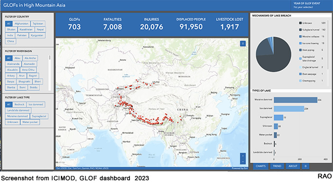
Dashboard: GLOFs in High Mountain Asia
|
Karakorum confirmed as High Mountain Asia's epicentre of recurrent GLOFs
New database records over 7,000 lives have already been lost to the phenomenon
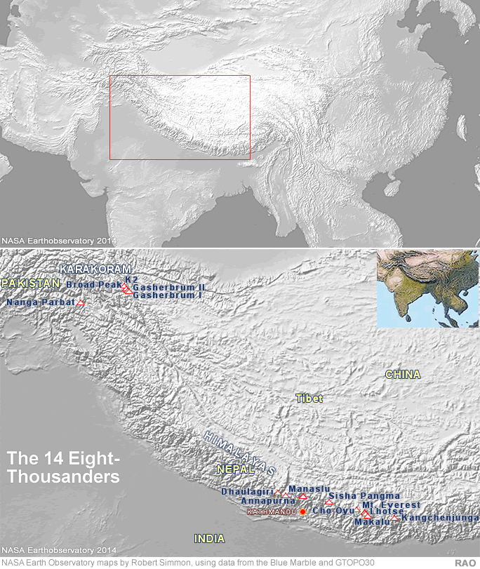
Karakorum, the world's second highest mountain range, has seen the highest number of recurrent recorded glacial lake outburst floods in High Mountain Asia.
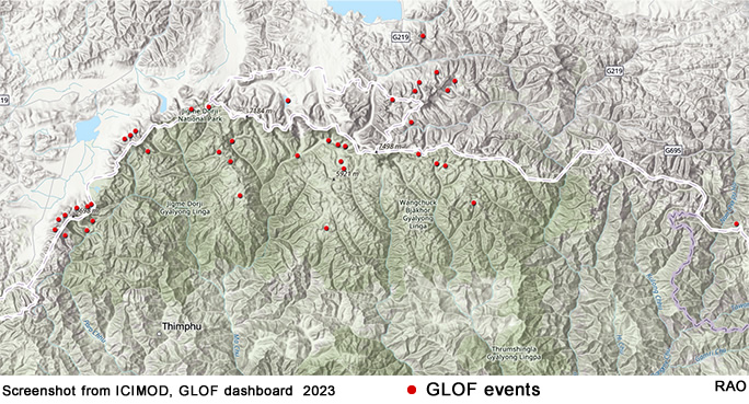
A new dataset, released by the International Centre for Integrated Mountain Development today, is a repository of over 700 glacial lake outburst floods dating back almost two centuries, and including recent devastating events, including GLOFs in South Lhonak in Sikkim and in Thorthomi in Bhutan in October.
"It is always a challenge to get historic data on High Mountain Asia, because the region is inaccessible, and research here has historically been so difficult," said Finu Shrestha. "Through painstaking collaboration with regional partners, we have managed to piece together a robust picture of major events in this region dating back to 1833.
"This provides us with a sense of how hazards are changing in the mountains over time, and a way of capturing their impacts. It will help us to track how temperature rises, permafrost thaw and precipitation, are driving these events and to monitor, guide, and improve mitigation measures to protect vulnerable human populations, biodiversity and hydropower investments."
The Hindu Kush Himalayan (HKH) region is recognised as a "hotspot of risk" for hazards such as GLOFs. The GLOF dashboard captures a number of key datapoints about each flood: date, time, place, volume of water; triggers; physical characteristics of the lake dam; and the impact in lives, livelihoods, property and infrastructure.
Dashboard: GLOFs in High Mountain Asia
Below are some key takeaways from the current records on the dashboard:
Over 7,000 people have lost their lives to GLOFs in High Mountain Asia in the past 190 years, with 102 deaths from South Lhonak event which is higher than the recent past.
Impacts from GLOF events have increased over threefold since the previous regional assessment, showing the importance of consulting local sources for accurate estimates of loss and damage
Development of high value infrastructure at higher elevation increases exposure to GLOFs.
23% GLOFs were recurrent events, with the highest frequency observed in ice-dammed glacial lakes in the Karakoram region, pointing to ongoing risks for local communities.
The overall increase in GLOFs is mainly due to better observations and reporting, but the overall damage to infrastructure from these events has likely increased in the recent past.
Over half (54%) of GLOFs were triggered by mass movement such as avalanches, rock falls and landslides (such as in Sikkim in 2023), while 18% were due to intense rainfall events. This points to a need for better forecasting of precipitation at altitude as well as mapping of an increasingly unstable cryosphere.
Without a major step up in both monitoring, mitigation and early warning for all, it is likely we will see more major examples of GLOFs such as South Lhonak. )pages/np/trek/trekpro/np_trekguide01c3f1.html)
The impacts of GLOFs originating in one country can occur in a second country, with eight GLOF events in China, for instance, having extensive impact in Nepal.
This dataset serves as a crucial foundation for further scientific investigation, such as enabling regional studies on potential GLOF drivers and providing a robust data basis for downstream impact and risk assessments. The initiative emphasises the crucial need for proactive measures to safeguard vulnerable communities in High Mountain Asia.
The GLOF dashboard visually presents this dataset on a regional map, offering seamless navigation. All data are openly accessible and downloadable for further investigations.
 |
| Source: ICIMOD, 15 December 2023 |
top
| Information on Bhutan |
 |
| Links |
|
 |
|
External
link |
|