| Nepal's
Glaciers - Climate Change |
 |
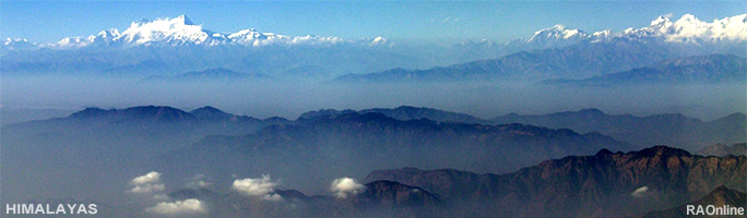
Nepal Himalayas Glaciers |
|
Nepal Information |
|
|
 |
| Nepal
Glaciers: Global Warming - Tsho Rolpa Risk Reduction Project |
|
Nepal Himalayas Glaciers |
|
Nepal Information |
|
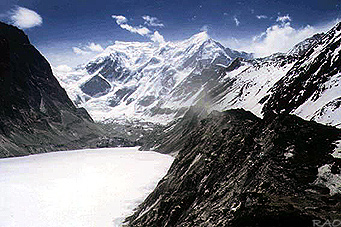 |
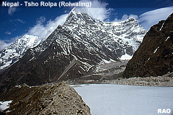
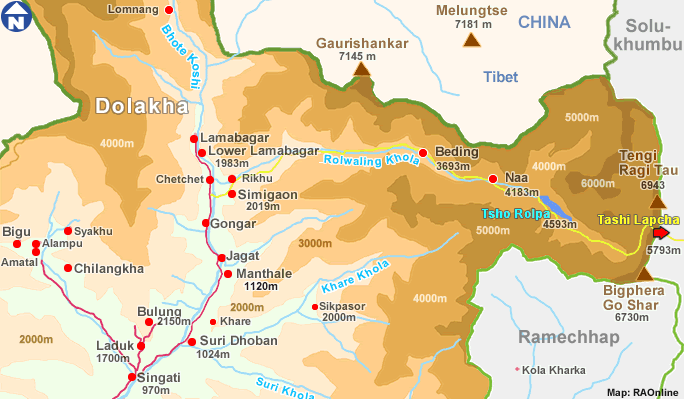
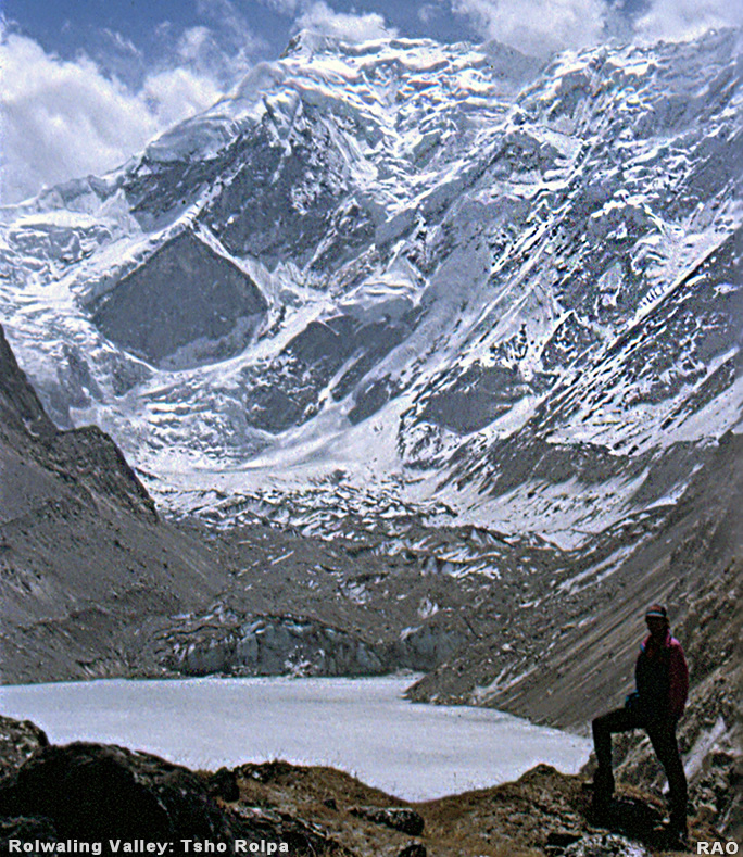
| Tsho
Rolpa, Rolwaling Valley, 1996 |
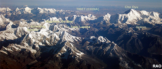
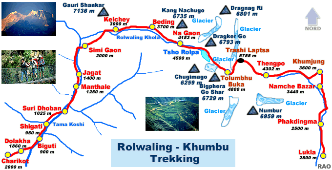
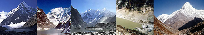
| The Tradkarding
glacier, which feeds the Tsho Rolpa glacial lake in Nepal's Rolwaling
Valley, is retreating at a rate of over 20 metres a year and, in some years
within the last decade, reached 100 metres per year.
This is the Tsho Rolpa
Lake that feeds the Rolwaling and Tama Koshi valleys in the Dolakha
District of Nepal. |
|
The
researchers have found that, as a result of the melting of a nearby glacier,
the lake has grown six-fold, from an area of 0.23 square kilometres (56
acres) in the late 1950s to one of 1.4 square kilometres (346 acres) now.
"A
flood from this lake could cause serious damage down to the village of
Tribeni, which is 108 kilometers (67 miles) downstream, threatening about
10,000 human lives, thousands of livestock, agricultural land, bridges
and other infrastructure," a researcher said.
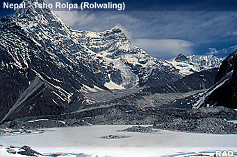
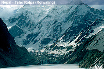
| Tsho
Rolpa Risk Reduction Project |
The Tsho Rolpa Glacial
Lake is located at an elevation of 4580m and is approximately 3 km long,
0.5 km wide and up to 130 m deep. It contains approximately 80 million
cubic meters of water and is the largest glacial lake in Nepal. The lake
is contained by a 140m high natural moraine dam that is unstable and threatens
to burst. The resulting flood would inundate parts or all of 20 villages
for over 100 km downstream, threatening up to 6000 lives, the construction
site for the 60 MW Khimti hydroelectric project, and other infrastructure.
In
August 1985,
a sudden out burst flood from the Dig Tsho glacial lake in Nepal
destroyed 14 bridges and $1.5 million worth of damage was caused to the
nearly completed Namche Small Hydropower Plant. The new research began
in 1999 and is based on topographic maps, aerial photographs and satellite
images from Landsat, Spot and IRS craft. The
survey has identified 3,252 glaciers and 2,323 glacial lakes in Nepal and
677 glaciers and 2,674 glacial lakes in Bhutan. The researchers estimate
20 glacial lakes in Nepal and 24 in Bhutan are potentially dangerous.
 |
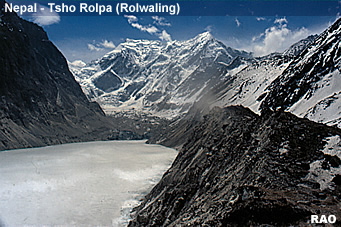
| Tsho
Rolpa, Rolwaling Valley |
| A
high tech communications network of sensors and sirens has been linked
from the lake to villages at risk from floodwaters. |
|
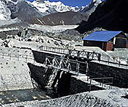 |
Engineering work has
finished to lower the water levels at Tsho Rolpa by 30 metres (98 feet).
The construction began in April 1999 and was stopped in October due to severe weather conditions and started
again in May 2000.
All
the construction work was completed by early June 2000 and the draw-down of the lake water-level was initiated on June 8, maintaining
below 25 cm per day to avoid catastrophic slumping and failure of moraine
slopes and damage to the canal lining. The level lowering was accomplished
on June 24, 2000.
The
reduction of lake water-level by three metre is just an immediate solution
and the second project named Tsho Rolpa GLOF Permanent Remediation Project
(TRPRP) aims to reduce the lake water-level by additional 17m making
20m lower from the original lake water surface and then only the lake
will be permanently free from GLOF risk.
The
risk of failure is considered to be high. As a result of the number of
lives at risk and the potential damage to the economy of Nepal, two projects
have been undertaken to reduce the risk to lives and the economy. The first
project, the subject of this paper, was the installation of a fully automated
remote warning system for the villages of the Rolwaling and Tama Koshi
Valleys. The Nepalese Government has installed in co-operation with
foreign partners a of the Glacial Lake Outburst Flood (GLOF) warning
system downstream of Tsho Rolpa.The second project was to lower
the lake initially by 3 meters.
| Sources:
GRIDA, UNDEP, Tsho Rolpa GOLF Risk Reduktion Project
|
 |
top
|
more information
|
|
| Snow, Ice, Glaciers, Glacial Lakes and Floods - Reports |
|
| Himalayas |
 |
Snow, Ice, Glacier, Glacial Lakes and Floods Reports |
 |
|
Links
|
|
 |
|
External
link |
 |
 |
 |
 |
 |
| GRID-Arendal
News |
NASA's
Global Change Master Directory |
United
Nations Environment Programme |
World
Glacier Monitoring Service |
International
Centre for Integrated Mountain Development |
|
 |
 |
 |
|
|
|
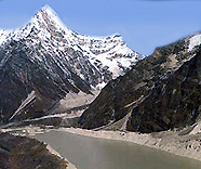
Tsho
Rolpa, Rolwaling Valley
|
|