 |
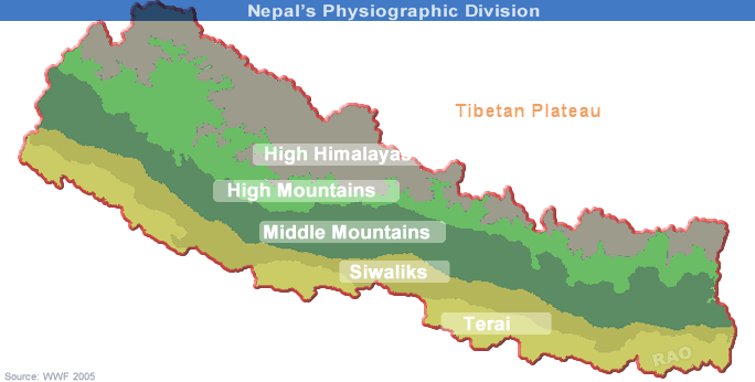
| Nepal's Topography |
|
|
|
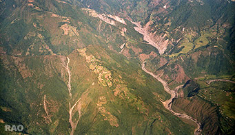
| Nepal's Foot Hills (Foot hill zone) |
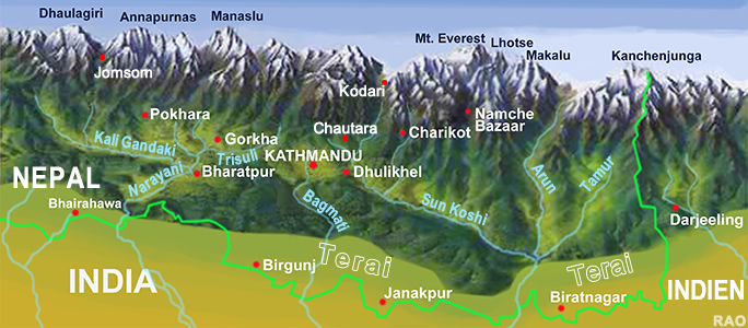
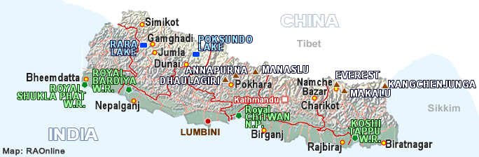
| Nepal
is situated between latitudes of 26°22' to 30°27' northand between longitudes of 80°4' to 88°12' east. The east-west length of the country is about 800 km, roughly parallel to the Himalayan axis, and the average north-south width is 140 km. |
|
| Within the 147,181 km2 area of the country, physiographic regions range from tropical forests in the south to the snow and ice covered Himalayas in the north. | |
| Nepal has a very diverse environment resulting from its impressive topography. |
 |
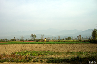
| Terai |
| Ecological regions |
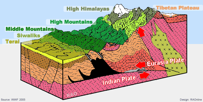
A cross-section of the country reveals that the topography generally progresses from altitudes of less than 100 m in the southern Terai plain, up to more than 8,000 m peaks in the north. Nepal can be divided into five ecological regions:
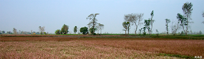
This is the northern part of Indo-Gangetic plain. The Terai extends nearly 800 km from east to west and about 30-40 km from north to south. The average elevation is below 750 m, including Terai region, Bhavar Terai and Inner Terai.
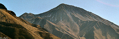
Commonly referred to as the Churia Hills, the elevation in the Siwalik ranges from 700 to 1,500 m.
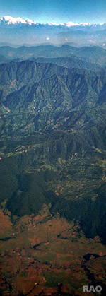
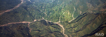
Also known as the Mahabharat range, the elevation of this range is from 1,500 to 2,700 m. The Middle Mountain is cut in many places by antecedent rivers such as Kosi, Gandaki (Narayani), Karnali and Mahakali. They are the first great barrier to monsoon clouds and the highest precipitation occurs on the southern slope of this range.
High Mountains range from 2,200 to 4,000 m. This region consists of phyllite, schists and quartzite, and the soil is generally shallow and resistant to weathering. The climate is cool temperate.
Ranges from 4,000 to above 8,000 m dominate the High Himalaya. Eight of the highest peaks in the world and the world's deepest gorge, 5,791 m in the Kali Gandaki valley, are located in this region. |
 |
The climate is alpine and the snowline lies at 5,000 m in the east and at 4,000 m in the west. The area lying to the north of the main Himalayan range is the Trans-Himalayan region, which restricts the entry of monsoon moisture and therefore the region has a dry desert-like climate.
Source WWF
 |
|
Nepal |
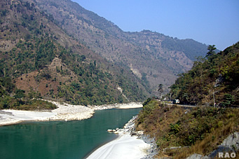
| Siwaliks |
|
 |
||
 |
 |
||
| Terai | Foot Hills |
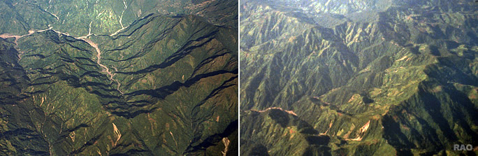 |
| Siwaliks: South of Kathmandu (Makwanpur district) |
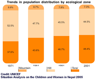
| Population Distribution |
 |
 |
|
|
|
|
UNICEF report: Situation Analysis on the Children and Women in Nepal 2006 |
|
|
 |
 |
| More information and pictures |
|
| Links |
| External link |
|
 |
|
|
|