| Langtang's glaciers in the past
|
 |
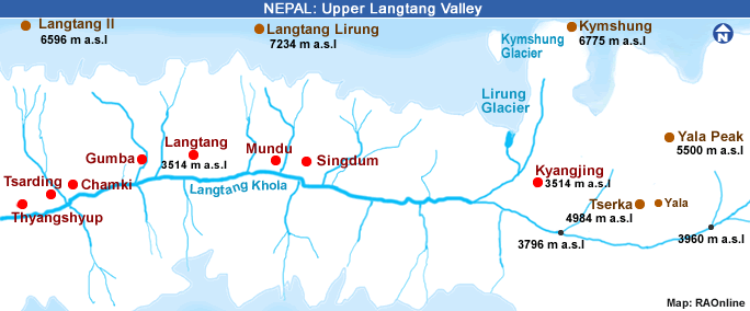
Yala Glacier is located in the Langtang Valley, Rasuwa district of Nepal 70 km north of Kathmandu. It is a plateau type glacier with an altitude range from 5,661 to 5,168 m a.s.l. In 2012, the length and area of Yala Glacier were about 1.2 km and 1.61 km2, respectively.
The glacier is mainly oriented southwest, and has many ice cliffs facing south and southwest. The nearest weather station with long-term data is in Kyangjing or Kyanjing (3,920 m a.s.l.), which is about 6 km horizontal distance and southwest of the Yala Glacier. The mean annual air temperature in Kyangjing is about 4 °C and the annual average precipitation is about 661 mm (1988-2012).
The main precipitation originates from monsoon systems during the summer months, and the rest from westerly disturbances mainly in the second part of winter and spring. Yala Glacier has been investigated since the 1980s by Japanese researchers. The mass-balance monitoring programme was re-established in 2011 by the Cryosphere Monitoring Programme of ICIMOD and partner organizations, and has been funded by the Government of Norway. The observations show that the glacier has been shrinking continuously, having retreated 354 m since 1974, with an annual average retreat rate of 8 m a-1. From 2014 to 2016, Yala Glacier retreated 15 m. The mass balances in 2015/16 and 2016/17 were -609 mm w.e. and -1,183 mm w.e., respectively, and the corresponding ELAs were 5,444 m and 5,486 m a.s.l., with an AAR of 31% and 19%. The glacier-wide mass balance was extrapolated based on the mass balance gradient as derived from the field measurements.
Source: ICIMOD 2018
|